Montenegro to receive new orthophoto imagery with EU support
Podgorica, (MINA-BUSINESS) – Aerial photogrammetric surveying of Montenegro’s territory has begun as part of the IPA 2021 EU Support Project for the Agricultural Sector in Montenegro, whose beneficiaries are the Ministry of Agriculture, Forestry and Water Management and the Agency for Payments in Agriculture, Rural Development and Fisheries.
The Ministry stated that the project is fully funded by the European Union, while the work is being carried out by the Polish company MGGP Aero under a contract worth €197,000.
The activities are scheduled to be completed by the end of September this year.
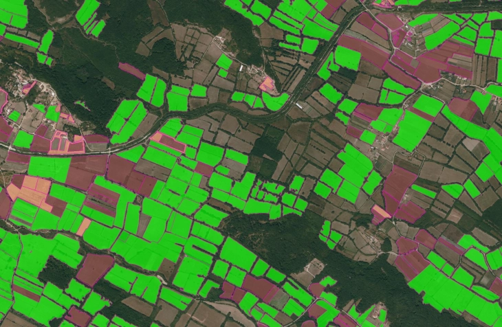
“The project will result in new Digital Orthophoto Maps (DOF) with a resolution of 20 centimetres, as well as a Digital Terrain Model (DTM) of Montenegro at a 5x5 meter scale, in accordance with current European Union standards and requirements,” the Ministry said in a press release.
According to the Ministry, the new data will provide a key foundation for improving the Land Parcel Identification System (LPIS/SIZEP) and for the further development of the Integrated Administration and Control System (IACS), both of which are essential for the efficient management of agricultural subsidies and alignment with the European Union’s Common Agricultural Policy (CAP).


